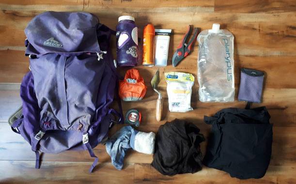
Today’s post isn’t exactly death-related, but I wanted to take a sec and share what I carry with me into the field. If you are starting out in archaeology or are heading into your first field season in cultural resource management (CRM) or a field school, I hope this post can be a little helpful to you!
I’ve been doing fieldwork on and off since 2011, in Ireland, the Isle of Man, the UK, and Canada (BC, NL, and ON), and these items are things that I always like to have on me, and items that have stood the test of time being dragged around the mountains, overseas, corn fields, and most recently the blistering heat and random rain storms of Ontario! Lets dive in and take a look at what’s in my (field) bag!
This Saturday I was invited to speak at and participate in a community heritage & folklore event in the town of New Perlican, Newfoundland. New Perlican is located on the eastern coast of the Avalon Peninsula, and has dated back to the 17th-century through records such as the 1675 Berry Census and archaeological evidence of a ‘plantation’ in the area. It is suspected that several of John Guy’s settlers from the 1610 Cupid’s Plantation may have settled in New Perlican in the early 17th century, but there has yet to be any physical evidence of that move identified.
The event I was involved with was a collaboration between the Heritage Foundation of Newfoundland and Labrador, Memorial University of Newfoundland, and Heritage New Perlican, and involved something really that I’m pretty passionate about…burial grounds! Students and community volunteers would join us for the day to learn about the history burial places in this historic town, hear about the town’s history from members of the Heritage group, meet the cemetery cleaning ‘Goats of New Perlican’, and help the community clean up one of their most historic burial spaces. I was there as an additional help supervising the students, to answer questions on burials and gravestones (and have some awesome conversations about headstone preservation with local folks!), and to give a talk about my research as a historic mortuary archaeologist. Also, to map a bunch of gravestones! Continue reading →
Halfway through through the fieldwork season, and I already cannot believe the amount of earth we’ve moved in pursuit of the burial ground! It’s amazing, thank you to the week 1 & 2 crews for all the hard work you put in, I couldn’t have gotten this far without all of you (and your digging hands)!
It was an amazing week over all, so lets dive right in to what we got up to at Ferryland last week:
17th-century building rubble from the brewhouse dismantling. We found lots of early-mid-17th-century objects between the fallen stones, as well as rich organic soil, charcoal, burned bones, and other organic material. Photo by author, 2017.
It’s time.
The trowels are cleaned*, the boots are dusted off**, and the car is ready and full of excited and bright eyed volunteers***. The fieldwork season has begun!
*it’s never really going to be clean again, is it?
**Same goes for the boots, they are as dusty as ever
*** No one is that bright eyed at 6:30AM!
If you remember from my last post, I had indicated where I was going to be excavating this summer by a large circle on the map. Of course, I’m not going to be digging literally all of the space inside that circle but a few select trenches to get a better idea of what is going on in the subsurface.
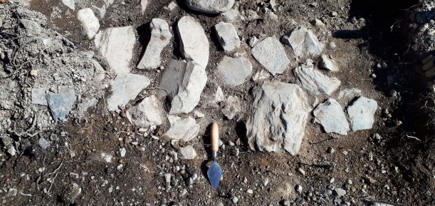
The first trench laid out over the gravel slope. It’s mostly slopewash and debris from above, and parts of the area were previously excavated so the ground lever was actually much higher than it currently appears to be! Photo by author, 2017.
Archaeology isn’t quite like they show it in the movies or on Time Team. Of course, we all wish we could just walk into an area, feel the wind, and know exactly where a site is but unfortunately it doesn’t work like that (and we usually have more than 3 days if excavations are happening too)!
Last summer during my excavation at Ferryland, there were quite a few moments that started out feeling as if we’d found something very dramatic, which quickly dissolved into mild disappointment and sighs. But that’s archaeology right? If you’re doing a project that is looking for something, rather than trying to see what was happening in general, then there are going to be a lot of empty test pits. This one wasn’t empty though…
This morning I thought it might be fun to talk about geophysical scanning techniques.
SmartCart with 500mhz antenna, GPR survey at Tors Cover, 2016. Photo by author.
If you are coming to this blog knowing about what I was up to in the field last year, or having read my CAA poster last week, you’ll know that I attempted a wide-scale Ground Penetrating Radar (GPR) survey at Ferryland, Newfoundland, in May of 2016, with the help of our wonderful curator and GPR tech, Maria Lear. I was looking for anomalies in the results that could indicate a burial in the subsoil, either high-contrast anomalies that might suggest a coffin or coffin hardware or a depression or slump in the soil layers where a grave had settled over time. What were my results? We’ll get to that in a moment!