Spade & the Grave

death and burial through an archaeological lens


Leave a comment

Burial Ground Surveying in Historic New Perlican: Public Talk & Maps

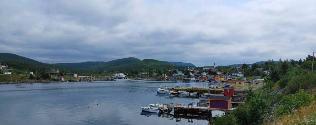
Hi friends, we’re back! This past Saturday we went out to New Perlican so I could give a little presentation to the community on my research in their burial grounds! It’s important for public archaeology that you actually tell the community you worked in about your research, so I was very excited to show off the maps and conclusions about my fieldwork surveys from the past 2 summers. I put together a little presentation showing the maps of the sides as well as several gravestone examples from each site to show everyone, and was able to tell them that we are going to be back in September to attempt GPR survey around St. Mark’s Cemetery to try and location the first Anglican church that was built in New Perlican. Stay tuned for that!

The purpose of my fieldwork and studying of these burial spaces was to take a closer look at the development of the burial landscape within a singular community, and how it has grown and evolved over the years, reflecting the community’s relationship with these spaces and mortality as a whole. We’ll also see some larger trends in burial spaces organization that are reflections of what we see in the rest of North America in the late 18th and 19th centuries. I also wanted to map these sites for the community, so that they would have a better record of gravestone location and site boundaries for future research and development.

View of New Perlican from Bloody Point (photo by author 2023)
Continue reading


2 Comments

PhD Fieldwork 3: Surveying Field Stones at St. Augustine’s Cemetery 1

This week we wrapped up my fieldwork surveying in New Perlican! This part of my project, which I’ve written about a few times already in earlier blog posts, involves using a total station theodolite to survey and record the location of gravestones at historic burial grounds in New Perlican in order to create maps of the sites for the local archives and to use in my dissertation research on the evolution of the burial spaces in a single community over 400 years. You can find those earlier posts here: PhD Fieldwork Part 1, PhD Fieldwork 2, and Burial Ground Mapping.

This last round of surveying (before all the total stations vanished to field schools and Labrador for the summer) took place at St. Augustine’s Cemetery 1, and yes, there is a second one of the same name! Due to the size and complexity (ie: trees) of the site, I decided to record only the field stones at this location. Often overlooked, field stones are locally sourced grave markers that typically don’t have inscriptions but show a lot of importance in burial marking traditions in a community.

The goats (and sheep) of New Perlican visiting us on site (2022)
Continue reading


6 Comments

Burial Ground Mapping in New Perlican: Total Stations & Gravestones

If you’ve been a reader for more than a minute, you might already know that some of my PhD research is taking place in the outport community of New Perlican. Well, I’m currently working on my second comps paper, and that means it’s time to write another blog post to let some of that writing energy go somewhere, now that I’ve met my page goal for the day!

Today I wanted to share the maps that were made for my project by my colleague Bryn, who is a mapper extraordinary and taught myself and Ian how to use the total station theodolite (TST or total station) ((which is something I need to remember finally, rather than re-learning every time I need to use one)). The benefit of using the total station to record the gravestones is that not only are they geo-referenced within cm’s accuracy, but it allowed us to create accurate maps of the gravestones for the community to have on record in their archives.

Bloody Point grave marker 1, BP1 (Lacy 2021). This is an excellent example of a rough fieldstone.
Continue reading


1 Comment

PhD Fieldwork 2: Graveyard Tours & NLAS talks

Back for another research blog instalment! The past few weeks have been pretty busy, with Black Cat projects, some comps reading, a camping trip and hiking in Gros Morne, getting my 2nd covid vaccine, and my parents coming out to visit. We still managed to sneak in a little community archaeology engagement though, which turned out to be sort of a conjuncture between the NLAS (Newfoundland and Labrador Archaeology Society) ((I’m the VP this year)) and my own research in New Perlican.

The town of New Perlican was holding their annual Heritage Day this past Saturday, and the NLAS went down with our museum in a box / ‘edukit’ to talk to anyone interested about archaeology in the province. I was also asked to give a short tour and talk about the Bloody Point burial site, which is part of my PhD research! Check HERE and HERE if you need to get caught up on the site! It was an amazing day, and I’m excited to share it with you all!

Looking towards New Perlican from the road to Bloody Point (photo by author 2021)
Continue reading


5 Comments

PhD Fieldwork Part 1: Surveying Burial Grounds in New Perlican, NL

I survived my first week back in the field! This past week was the first week of my PhD fieldwork and I could not be more excited to share it with all of you! I find blogging about my fieldwork and research as a go a really good way to gather my thoughts about the process, as well as share all of that with you, dear readers, who may not be archaeologists or know what goes into archaeological research.

My fieldwork this week involved surveying some of the historical burial grounds in New Perlican. Part of what I’m interested in exploring in my PhD research is the development and changes to the burial landscape within a community. New Perlican has been the home of settlers for about 400 years, and I will be exploring how their burial spaces changed and evolved with the community through the years! Part of that work is recording and mapping the older burial grounds themselves, taking stock of the gravestones that are in each site, the styles, how the community used and related to the sites.

Most of that analysis is for later though, this week was the mapping itself! Buckle in folks, this could be a long one.
(all photos in this post were taken by me)

View from the Hefford Plantation (photo by author 2021)
Continue reading


4 Comments

Site Visit to Bloody Point, New Perlican, NL

Another summer, another field season! While I couldn’t really write much last summer in the field, because I was working in CRM in Ontario, this year I’m back in Newfoundland doing my own research. You know what that means…updates from the field, as far as the eye can see! I’m really looking forward to getting back to some research surveys rather than just digging test pits as fast as possible in the sun (as important as CRM is).

Today myself and my husband Ian joined my supervisor Dr. Shannon Lewis-Simpson in the outport community of New Perlican, in Trinity Bay. If you’ve been following my blog for a while, you might remember when I did work at one of the cemeteries in New Perlican in 2017 (you can find those posts HERE and HERE). Part of my dissertation research for PhD is looking at the development of the burial landscape in New Perlican, which has been settled by European settlers since the 17th century, and how those burial spaces changed in relation to the settlement and the churches through the centuries to today. Today’s trip, however, was just to visit the site of the Bloody Point cemetery…a site which we suspect could date to the 17th century!

Beautiful fishing stages in New Perlican harbour (photo by Ian Petty 2021)
Continue reading


3 Comments

New Perlican: Blank Gravestones & Mapping

22627581_10155298965582983_2012522379_n

Myself, mapping away on our plan of St. Mark’s! Photo by Ian Petty

Yesterday I headed back to New Perlican with Ian Petty (2nd year MA student in Archaeology at MUN) to meet up with Dr. Shannon Lewis-Simpson from Memorial University of Newfoundland in order to continue with the surveying of the St. Mark’s historic burial ground. The weather was not ideal and I was hard-pressed to remember if we’d used a plastic drafting film or normal paper to draw the map on in the first place, so with rain in the forecast our fingers were crossed!

I wanted to go get as much of the burial ground mapped as possible before the rain set in…and before I had to start my new job! There will be more details on that major life change later though, this post is still about the burial ground in New Perlican.
Continue reading


7 Comments

Community Mortuary Archaeology & Folklore – New Perlican, Newfoundland

This Saturday I was invited to speak at and participate in a community heritage & folklore event in the town of New Perlican, Newfoundland. New Perlican is located on the eastern coast of the Avalon Peninsula, and has dated back to the 17th-century through records such as the 1675 Berry Census and archaeological evidence of a ‘plantation’ in the area. It is suspected that several of John Guy’s settlers from the 1610 Cupid’s Plantation may have settled in New Perlican in the early 17th century, but there has yet to be any physical evidence of that move identified.

The event I was involved with was a collaboration between the Heritage Foundation of Newfoundland and Labrador, Memorial University of Newfoundland, and Heritage New Perlican, and involved something really that I’m pretty passionate about…burial grounds! Students and community volunteers would join us for the day to learn about the history burial places in this historic town, hear about the town’s history from members of the Heritage group, meet the cemetery cleaning ‘Goats of New Perlican’, and help the community clean up one of their most historic burial spaces. I was there as an additional help supervising the students, to answer questions on burials and gravestones (and have some awesome conversations about headstone preservation with local folks!), and to give a talk about my research as a historic mortuary archaeologist. Also, to map a bunch of gravestones!
Sept30_1 Continue reading