I survived my first week back in the field! This past week was the first week of my PhD fieldwork and I could not be more excited to share it with all of you! I find blogging about my fieldwork and research as a go a really good way to gather my thoughts about the process, as well as share all of that with you, dear readers, who may not be archaeologists or know what goes into archaeological research.
My fieldwork this week involved surveying some of the historical burial grounds in New Perlican. Part of what I’m interested in exploring in my PhD research is the development and changes to the burial landscape within a community. New Perlican has been the home of settlers for about 400 years, and I will be exploring how their burial spaces changed and evolved with the community through the years! Part of that work is recording and mapping the older burial grounds themselves, taking stock of the gravestones that are in each site, the styles, how the community used and related to the sites.
Most of that analysis is for later though, this week was the mapping itself! Buckle in folks, this could be a long one.
(all photos in this post were taken by me)

The first site we visited on Monday was the St. Matthew’s United Church Southside Cemetery, overlooking the harbour on an eroding bluff. The site appeared fairly small, but ended up containing over 25 grave markers, the majority of which were little wood crosses in two rows. The site was absolutely lovely and covered with flowers! We set up a datum in the neighbouring yard (thank you!) in order to survey both this site and the adjacent heritage site, Hefford’s Plantation.

In the field this week I was aided by Bryn and my husband Ian. Bryn is another PhD in our archaeology department, and is amazing with mapping tech! We were in good hands re-learning how to use a total station, which I hadn’t really operated since my field school in 2011, I think! With the help of a cheat-sheet, we were able to get the hang of it pretty quickly, and get to mapping!
The process for mapping with a total station involves a lot of set-up steps, most of which involve spinning the antenna around in a circle while trying to get the various bubble levels to stay in the centre. Then the prism is used to read the location in X-Y-Z coordinates, which can be used to map out the site! The least technical explanation, right?
Next to St. Matthew is the Hefford Plantation, a 17th-century plantation site from at least the last quarter of the 17th century, if not earlier. Heritage NL’s designation webpage says
“In the fall and winter of 1619/1620 Thomas Rowley, a planter at Cupers Cove (now called Cupids) was making plans to establish a plantation at New Perlican. Rowley had been living at Cupids since at least 1612 and had accompanied John Guy on his voyage into Trinity Bay in the fall of that year. It is unclear if Rowley actually did move to New Perlican, but his records prove the existence of the community from a very early time.”

Hefford gravestone 5 
Hefford gravestones 1-3
The Hefford Plantation burial ground has five grave markers; one limestone headstone from the 18th century to some of the Heffords, and four fieldstones made from locally sourced shale. As you can see from the photos, the site is extremely well maintained, and the stone is in pretty good condition as well. The main headstone’s inscription was repainted in at some point, which is definitely something we want to avoid repeating. It doesn’t help the conservation of the stone at all! The best thing to do is keep a good record of the inscription in the archives, and digitised for the public!
We were able to get the first two sites recorded completely on Monday, so Tuesday we were able to move on to Bloody Point burial ground (ClAi-12). First recorded as an archaeological site in 2019, I did a site visit there recently to get the lay of the land…in the pouring rain, of course! When we arrived and began to do the field surveying, a few more gravestones appeared from the layers of grass on the hillside, which was exciting to see! We shot in the stones, and I recorded the inscription of the single inscribed gravestone known at the site, and I photographed the stones (24 of them) while Ian and Bryn worked to record the landscape. Recording the landscape is important to the research project, because it will show us where human alterations to the land are in relation to the burials. Things like the remains of root cellars, garden plots, and stone boundaries between the gardens were recorded, and I’m really looking forward to seeing the finished maps!

Sketchmap over the 2019 GPR plot of Bloody Point 
Bloody Point marker 17 (photo by author 2021)
The only inscribed stone, as far as I could make out, read:
In Memory of
JAMES MATCHEM[?]
who departed this life [9/8?] [April] [1817?]
Aged […] Years
________
This inscription was followed by a long poem, all in italics. I could not make out much of that text due to the deteriorated face of the limestone, but we are planning to return and try a photography technique to light the gravestone artificially called RTI (Bryn, correct me here if I’m way off on that description). Fingers crossed it shows us a little more of the stone!
After Bloody Point, we headed over to the large, and extremely interesting, St. Mark’s Anglican Cemetery. It seems like the earliest gravestone with an inscription dates to the 1820s, but we don’t actually know how long the site was in use. It likely wasn’t consecrated until well after that date, and fell out of use around 1895, when St. Augustine’s Anglican Cemetery #1 opened on the other side of town (#2 was opened in 1940). A visiting bishop commented in a 1828 newspaper that he visited St. Mark’s for an outdoor service, but did not note a church at the site at that time. It is likely that St. Mark’s was used as a community burial ground before the arrival of permanent clergy in New Perlican, as there were no established churches until the early 1800s in Newfoundland (Pocius 1981). We did surveying at St. Mark’s in 2017 and surveyed some of the gravestones with students from MUN. In that survey we reached 135 gravestones, but that wasn’t even the literal half of it!

As we started shooting in the gravestones on Wed, more and more field stones appeared from the grass (thank you Doug for whipper-snippering the site with such care!) and we were number over 150 before we reached the halfway mark! Somehow we managed to get the entire site shot it in one day (sort of, we did the boundaries the day before), and hopefully captured all of the gravestones. In total, we recorded a staggering 306 grave markers at the St. Mark’s Cemetery! Of course, this is likely not the total number of individuals buried here, as there are always a number of unmarked graves in historic, and contemporary, burial sites.
I annotated the sketch-map of St. Mark’s while we worked through the site, and did an additional map for the west half of the site which is by no means to scale, but you can see those maps below. I’ll definitely be posting the finished digital maps from Bryn, when they are ready to be shown!

Measured sketch-map from 2017, annotated 2021, east side. 
2021 sketch-map of west side of St. Mark’s, not to scale.
Unfortunately, Thursday was a rain day, but because we were able to record St. Mark’s on Wed I wasn’t too worried about finishing the rest of our work on Friday! First, we headed to Jane Condon’s grave, another municipal heritage site in New Perlican, over on the west side of the community off Gut Road. The site is quite small, sitting close to the water on a low slope that definitely would have been gardens and/or someone’s home. The site has one limestone headstone, and two field stones from a local material behind as well. It only took us 45 minutes to shoot the site in, and I got to eat a couple lovely wild strawberries along the way! The inscription on the Condon stone was lovely, as well, reading:
IN
Memory of
JANE the wife of JOHN CONDON
who departed this life the 22 day of June
1816.
Aged 58 Years.
. . _________ . .
Death can’t disjoin who Christ hath joined in love
Life leads to Death & Death to Life alone:
In Heaven [is?] a happier place d[….]
Live well to gain in future life the [prize]
The top portion of this stone was broken into seven pieces at some point in the past, and was reattached using what appears to be rubber cement, and the face of the stone is partially painted. As I have talked about a bunch in the past, paint a gravestone creates a barrier which traps moisture inside the gravestone, which means it will weather and deteriorate quicker. Please refrain from painting gravestones! Once Jane’s grave site was recorded, we headed over to historic Pinsent’s Lane to locate the graves there. They are inside a fenced enclosure next to the lane, so we weren’t able to get them recorded with the total station, but Bryn did take GPS points with a handheld GPS so we can still include them in the maps. Bonus of this site is that not only are the gravestones sheltered from the wind, but they are guarded by an adorable cat!

Jane Condon’s gravestone (photo by author 2021) 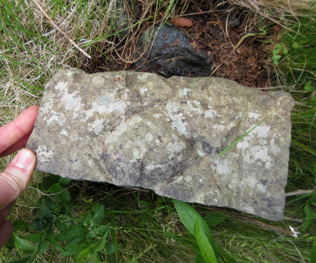
Field stone at St. Mark’s Cemetery with a fish carved on the top. 
Ian meeting a cat at Pinsent’s Lane in Mew Purrlican 
The goats of New Perlican! 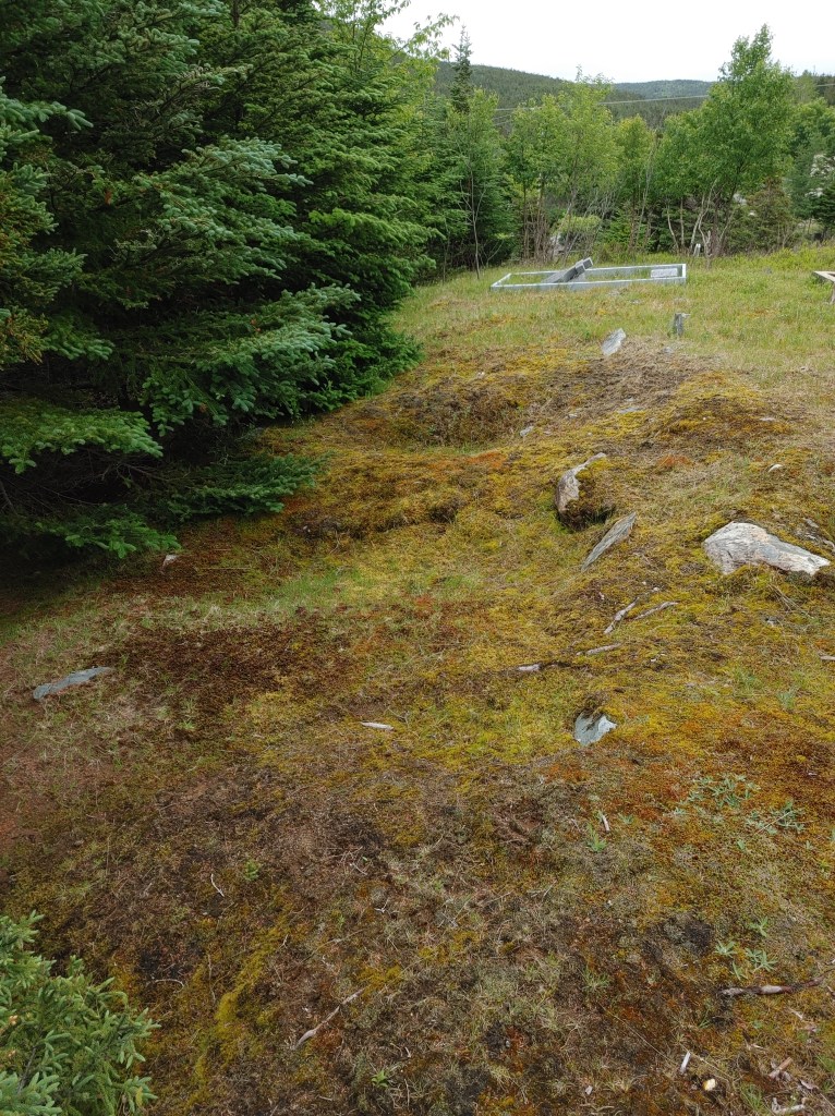
Several grave depressions at St. Augustine’s #1
After those sites were photographed and recorded, we set about doing some general points around the community in order to more accurately georeference the map points, and by around 1pm we were finished with the work for the week! I decided to take a quick look at the St. Augustine’s Anglican Cemetery #1 before we left, and we were all excited to meet the goats of New Perlican while we were out there. They help keep the foliage under control at the cemetery! I am not planning on mapping the entirety of this site as it was used into the 1940s and has better records, but upon arriving we noticed way more field stones than I remembered, so I am going to be scheduling another fieldwork day sometime in August so we can map at least the field stones and perhaps the location of the noticeable unmarked depressions. It will be interesting to see the distribution of these stones!
And that’s it! On the way home, we stopped at Dark Star Coffee Roasters in Carbonear for coffee (possibly the best flat white I’ve ever had) and made our way back to St. John’s! I organised my fieldwork photos, and started writing this blog post. A big thank you to everyone who chatted to us this week! We’ll be going back to New Perlican a couple more times this summer, including on August 14th for New Perlican Heritage Day where I’ll be giving a little talk/tour of some of the burial grounds in the community. If you’re in the area, come join in the festivities!
As always, thanks for reading!
References
Heritage NL. 2015. Hefford Plantation Municipal Heritage Site. Heritage NL. Website: https://heritagefoundation.ca/heritage-property/hefford-plantation-municipal-heritage-site/.
Lewis-Simpson, Shannon, Lear, Maria, Onah, Rita, and Elsa Simms
2020. Interim Report: An Early European Burial Ground at Bloody Point 2, New Perlican. Available on Facebook: https://m.facebook.com/nt/screen/?params=%7B%22note_id%22%3A2024430624354270%2C%22entry_point%22%3A%22MOBILE_POST_ATTACHMENT%22%7D&path=%2Fnotes%2Fnote%2F&state.
Pocius, Gerald. 1981. Eighteenth- and Nineteenth-Century Newfoundland Gravestones: Self-Sufficiency, Economic Specialization, and the Creation of Artifacts. Material Culture Review. Volume 12 (Spring): 1-16.

July 9, 2021 at 4:38 pm
Fascinating! Are you coming back to the London Ontario region? Would love to meet up with you and trail you around/assist/show you our local cemetery. .
LikeLiked by 1 person
July 13, 2021 at 2:02 pm
Hi there, thanks for supporting my work! At the moment no, I’m based in Newfoundland and Labrador 🙂
LikeLiked by 1 person
July 17, 2021 at 8:15 pm
A lot of what you said is outside of my reach, but I can appreciate your passion and diligence. As they say here on the Rock, keep up the good work!
LikeLiked by 1 person
Pingback: PhD Fieldwork 2: Graveyard Tours & NLAS talks | Spade & the Grave
Pingback: PhD Fieldwork 3: Surveying Field Stones at St. Augustine’s Cemetery 1 | Spade & the Grave