Tomorrow is the day! The 2017 excavation at Ferryland is finally going to start and I couldn’t be more excited! (That’s a lie, I will be more excited when I get on site tomorrow). I wanted to take this opportunity to tell you all a bit more about this year’s excavation and where I am taking it for the next 4 weeks. I’ll be blogging every week about the latest adventures and finds as well and I hope you all come along for the ride!

Map made by Robyn Lacy & Bryn Tapper, 2017.
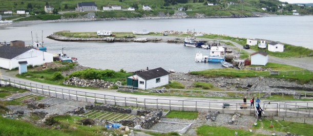
This is a map I made under the guidance of Bryn Tapper, a PhD candidate in my department who knows way more about GIS that I do! It’s an aerial photo of the Ferryland harbour, centered on the 17th-century British settlement area in the Pool, with a later, known burial ground circled in red on the left side of the image. The Pool refers to that little curl of land in the middle of the image, which formed naturally, if you can believe it! It’s the perfect little protected harbour, and deep enough to bring ships into, making it a wonderful location for a small settlement 400 years ago.
Continue reading


 In a place often referred to as ‘The Rock’, it sounds a bit redundant to be importing gravestones, but for a period in the 18th-early 19th century, that is exactly what people in Newfoundland were doing. By people, I of course mean people who could afford to have gravestone carved overseas and shipped across the ocean. There are locally carved gravestones as well going back to the 17th-century! I even have a puzzle for all of you gravestone enthusiasts out there, but we’ll get to that in a moment.
