Here we are, 3/4 weeks complete for the 2017 field season!
Cumulatively, this makes my 9th week excavating at Ferryland in search of the 17th-century burials. Lets go over what we uncovered this passed week, and then I’d like to talk about visitors to public archaeology sites and what we know so far about the burial ground!
Halfway through through the fieldwork season, and I already cannot believe the amount of earth we’ve moved in pursuit of the burial ground! It’s amazing, thank you to the week 1 & 2 crews for all the hard work you put in, I couldn’t have gotten this far without all of you (and your digging hands)!
It was an amazing week over all, so lets dive right in to what we got up to at Ferryland last week:
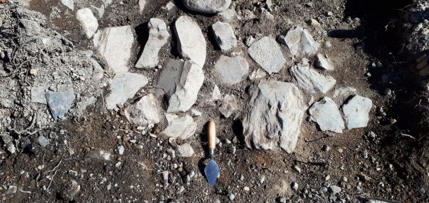
17th-century building rubble from the brewhouse dismantling. We found lots of early-mid-17th-century objects between the fallen stones, as well as rich organic soil, charcoal, burned bones, and other organic material. Photo by author, 2017.
It’s time.
The trowels are cleaned*, the boots are dusted off**, and the car is ready and full of excited and bright eyed volunteers***. The fieldwork season has begun!
*it’s never really going to be clean again, is it?
**Same goes for the boots, they are as dusty as ever
*** No one is that bright eyed at 6:30AM!
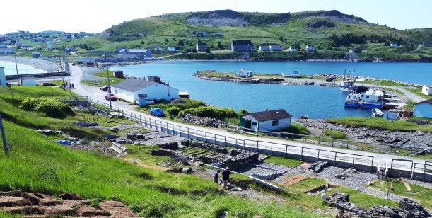
If you remember from my last post, I had indicated where I was going to be excavating this summer by a large circle on the map. Of course, I’m not going to be digging literally all of the space inside that circle but a few select trenches to get a better idea of what is going on in the subsurface.
The first trench laid out over the gravel slope. It’s mostly slopewash and debris from above, and parts of the area were previously excavated so the ground lever was actually much higher than it currently appears to be! Photo by author, 2017.
Tomorrow is the day! The 2017 excavation at Ferryland is finally going to start and I couldn’t be more excited! (That’s a lie, I will be more excited when I get on site tomorrow). I wanted to take this opportunity to tell you all a bit more about this year’s excavation and where I am taking it for the next 4 weeks. I’ll be blogging every week about the latest adventures and finds as well and I hope you all come along for the ride!
Map made by Robyn Lacy & Bryn Tapper, 2017.
This is a map I made under the guidance of Bryn Tapper, a PhD candidate in my department who knows way more about GIS that I do! It’s an aerial photo of the Ferryland harbour, centered on the 17th-century British settlement area in the Pool, with a later, known burial ground circled in red on the left side of the image. The Pool refers to that little curl of land in the middle of the image, which formed naturally, if you can believe it! It’s the perfect little protected harbour, and deep enough to bring ships into, making it a wonderful location for a small settlement 400 years ago. Continue reading →
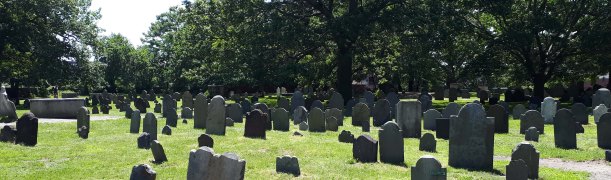
I recently had the pleasure of visiting some of the historic burial grounds in Salem, Massachusetts during my recently holiday to the area. I was particularly excited to visit Salem because it was not only an important site in the history of colonial New England, but it was a part of the survey I did of settlements for my MA research so getting to see it in person was a real treat! I decided to use the opportunity as a case study to investigate a particularly popular gravestone design. Continue reading →